Te Araroa Stories: The South Pole Chef, the Atlantic Rower, and the Truck Driver Who Saved My Day
My goal for staying in Twizel was simple: eat as much as humanly possible. I started at the bakery for breakfast, wandered to the supermarket for a snack, stopped at a café for a pastry, had lunch at an Asian restaurant, grabbed another snack at the supermarket, and wrapped up with dinner in yet another restaurant. By the evening, with a stomach operating at 120% capacity, I could confidently declare the day a success. As a bonus on this gastronomical adventure, I randomly met a pair of Czech travellers in the bakery (the world is small).
The Night Adventure
The hiking plan for the next day was a bit unusual. Unlike a normal day, I planned to start hiking in the middle of the afternoon instead of the morning. The next section was 60 km to Lake Tekapo, following a water canal with absolutely no shade, and some hikers prefer doing it at night. At first, I wasn’t exactly thrilled about hiking in the dark, but then I realised the area is a Dark Sky Reserve with almost zero light pollution. That sealed the deal and I decided to embrace the night challenge.
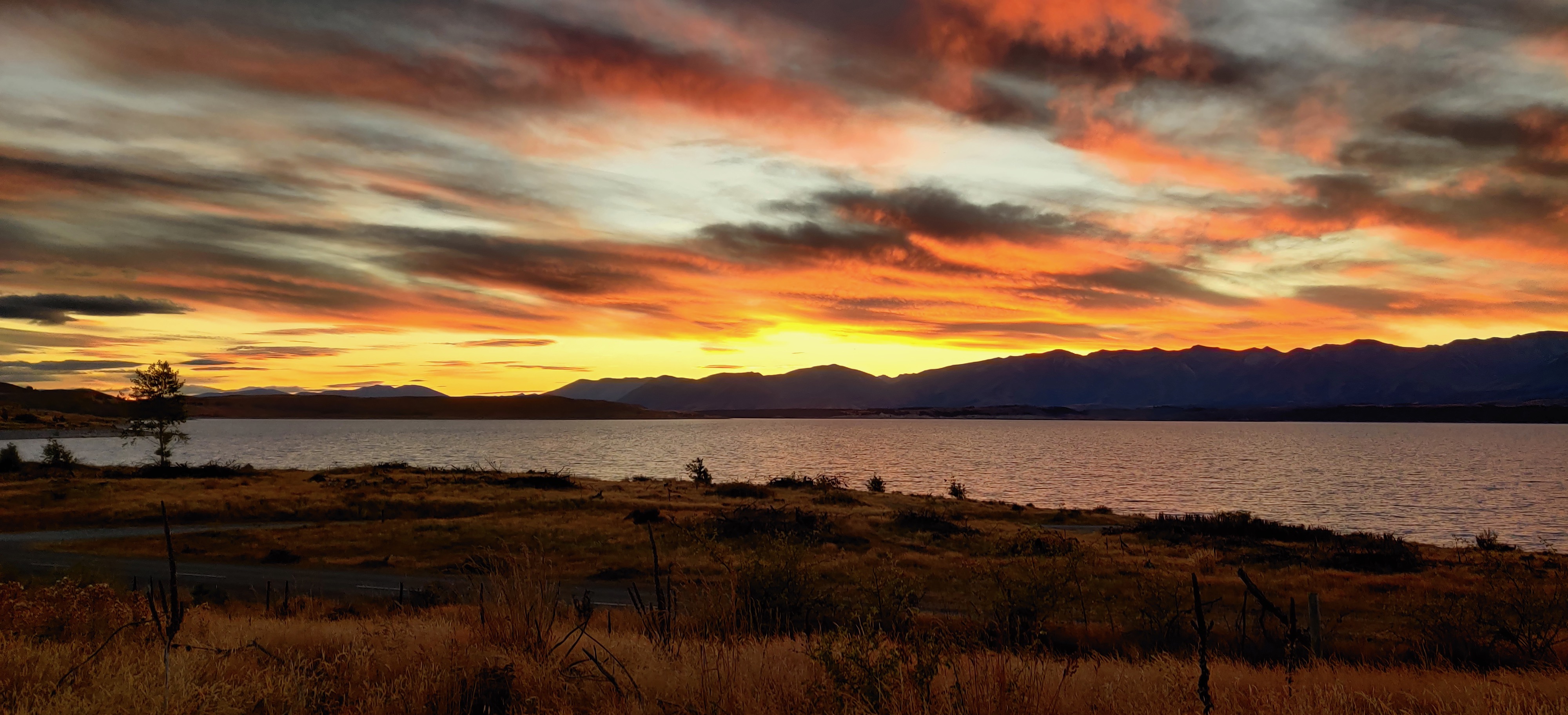
It took me several hours until I got to the canal. I could appreciate views of Mt. Cook (the highest peak of New Zealand) in the setting sun and then dramatic red sky over the Lake Pūkaki as the darkness was setting in. When I finally reached the asphalt road (closed to cars) that runs beside the Tekapo Canal, I switched off my headlamp and followed the white line down the middle of the road, gazing up at a sky full of stars, with the Milky Way starring in the main role and the Large and Small Magellanic Clouds as supporting actors.


At 2:45 a.m., with 49 km already in my legs, I finally hit that special level of exhaustion where even my exhaustion felt exhausted. I still had 8 km to go before Lake Tekapo, but it dawned on me (well, figuratively—actual dawn was hours away) that arriving in the middle of the night would make finding accommodation… tricky. Instead, I took shelter in a tiny forest near Patersons Ponds, grabbed a few hours of sleep, and decided to finish the last stretch in daylight—like a rational, functioning member of society.
When I rolled into town the next day, I caught up with a few hikers I’d met earlier. One of them was Roee from Israel, who’d rescued me at Top Timaru Hut by donating an emergency roll of toilet paper when I was, quite literally, shitting my pants. Trail angels come in many forms. Feeling fully recharged, I happily invited him for a beer as thanks for preventing a small-scale humanitarian crisis.
South Pole Chef
The section after Lake Tekapo climbs over Stag Saddle (1925 m a.s.l.), the highest point of the TA. It began with a mind-numbing road walk along the lake—no shade, no mercy—before the trail finally tilted upwards into the mountains. Luckily, something happened that made this part slightly less boring.
I was trudging along the roadside when a woman on a mountain bike rolled past me. She was moving slowly, basking in the scorching sun like a lizard celebrating the end of hibernation. Moments later, I understood why.
Woman: “Aren’t you walking Te Araroa trail?”
Me: “Yes.”
Woman: “I hiked PCT and I would like to hike Te Araroa one day as well. My trail name is Wyoming.”
Woman: “Wow, the sun is perfect! So warm.”
Me: “It is a bit too hot for me.”
Woman: “I just returned from the South Pole after almost half a year.”
Me: 😲
It’s not every day that I meet someone who worked as a cook at the Amundsen–Scott South Pole Station, and this encounter made an otherwise boring road walk a little more interesting. Then I finally started heading up into the mountains and got beautiful views of Lake Tekapo. Originally, I wanted to reach the hut, but when I saw a beautiful camping spot, I decided to call it a day and pitch my tarp in the setting sun with views of Lake Tekapo.


Beware of Parrots
The next morning, the sun was hiding behind thick clouds. The hike up to Stag Saddle was livened up by an unexpected wallaby sighting and a ridiculously windy ridge walk. Luckily, I didn’t get blown off the mountain like a budget Mary Poppins and managed to reach the highest point of the trail in one piece.
From there, I continued to Crooked Spur Hut—a place I’d been warned about by other hikers. Apparently, it’s the kind of hut you must sleep in, because the local keas (cheeky, highly intelligent alpine parrots) love to investigate tents. And by “investigate,” I mean “land on them and rip them to shreds with great enthusiasm.” So getting to the hut early felt like a smart choice. Even so, I arrived to find I was already the third person sleeping on the floor. We ended up with 12 hikers squeezed into an 8-bunk hut, but someone told me they’d been there once with 20 people inside. Cozy? Yes. Comfortable? Questionable. Better than watching a kea dismantle your tarp? Absolutely.
The next day was important. I needed to either cross or bypass the Rangitata River. It’s a huge braided river with a 3 km–wide bed split into many channels. Crossing can be dangerous: high water creates strong currents, and sudden rain in the mountains can cause a rapid rise, leaving hikers stranded on tiny gravel islands like confused castaways. Because of this, the river is only passable under the right conditions. Otherwise, you have to detour to a bridge 60 km away—the official bypass—turning a 3 km crossing into a 120 km ordeal. That’s why many hikers rely on a shuttle or try to hitchhike.
My plan was to ask a few SOBOs who had just crossed whether the river was safe or if I should take a shuttle. Unfortunately, there was no cell reception on my side, so I couldn’t check the water flow and had to rely on other hikers. When I reached the crossing, no one had gone through that morning, but a shuttle was waiting for hikers—including a group of SOBOs who had taken it earlier. Since I was alone and didn’t want to risk a dangerous river crossing, I took the shuttle as a sign to play it safe.
It turned out to be an excellent decision: during the ride I met Hannah, Netta, and Oriel, whom I ended up bumping into several more times on the trail—and even later back in Europe.


In Between the Rivers
After a short resupply stop in Geraldine (which included a surprisingly delicious Subway sandwich), I continued on the other side of the river. Some hikers chose to stay in town, so it ended up being just Hannah and me heading out that day. She decided to take a shortcut and hop off the bus a bit earlier because of her tight visa timeline, while I stayed on until the proper trail start after the river bypass.
My plan from there was to walk two more days to the Rakaia River—the second major river on the trail. Unlike the Rangitata, this one isn’t safely crossable at all. I’d heard stories of people drowning or almost drowning, and that was enough for me. Here, the bypass isn’t just recommended—it’s mandatory, and almost everyone takes it without argument.
The section between rivers was pretty. I met few hikers, and the ones I met were some of the last SOBOs from the main SOBO group of that year. The second day between the rivers was one of the bigger days on the trail, and I did 46 km in difficult terrain, including a few kilometers in the bed of the North Branch of the Ashburton River, which involved a lot of boulder hopping and crossing the same river about 30 times because the banks were steep and it wasn’t possible to walk on just one side. At the end of this day, I got to the beautiful tiny hut called Frame Hut, where I caught up with Hannah. It was nice to talk to someone and share a few moments from the trail together.
Hannah was from the UK. She was a teacher, rowed competitively and she was also a Badass with capital “B”! Because when we talked about other adventures we’d done, she casually told me that she had rowed across the Atlantic Ocean with two other women! That adventure was part of a race, and the whole journey took them 52 days. This moment made me feel like walking the length of New Zealand was not such a big deal after all.


The next day, just a few kilometres after Frame Hut, I reached the Rakaia River. There was no shuttle service running and almost no traffic, so I assumed I’d be waiting a long time for a ride. But after about half an hour of walking along the road, the first car appeared. I stuck out my thumb with low expectations; it was a truck, after all, and truck drivers usually don’t stop for random, dusty hikers.
To my surprise, the truck actually slowed down. The driver, a woman named Rachel, leaned out and told me to hop in. A few minutes into the ride, she admitted she had never picked up a hitchhiker before. She became a truck driver a few years earlier after her partner (who was a truck driver) passed away. She told me she loved the job and was excited to show me her “office view,” which, to be fair, was much better than any office I’ve ever worked in.
After a while, we spotted Hannah, who had started hiking earlier that morning, walking along the road. Unfortunately, the truck only had two seats, so we couldn’t pick her up. When she saw me riding comfortably in the cab, she burst out laughing and swore at me at the same time, which I took as a sign of friendship. Meanwhile, I just waved from my VIP seat in Rachel’s mobile skyscraper, feeling only slightly guilty.
.")
Rachel took me all the way to Methven, where I decided to stay overnight. I got a great burger at the local restaurant and met with Hannah, who arrived about one hour after me.
If you want to know how my journey continued and how I dealt with trench feet, you can keep reading here.